Auction: Books & Manuscripts - 2483Location: BostonDate / Time: November 15, 2009 11:00AM
Description:
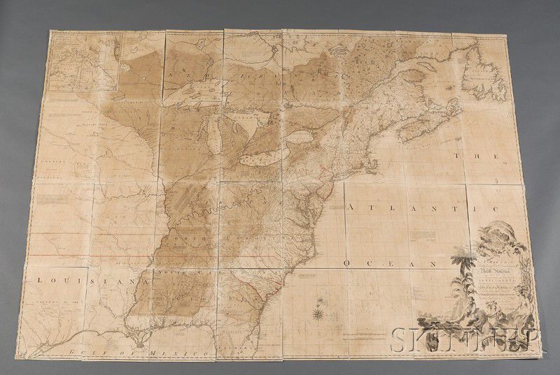
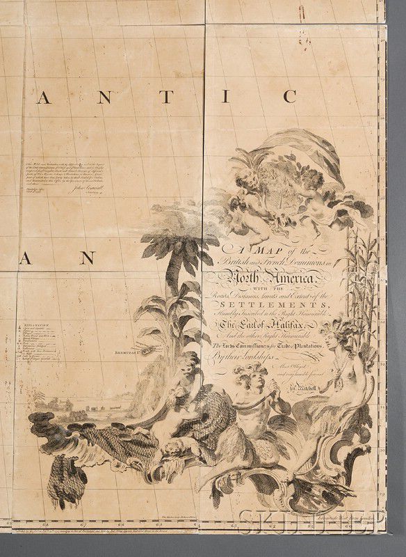
(North America),A Map of the British and French Dominions in North America. With the Roads, Distances, Limits, and Extent of the Settlements, London: Published by the Author, February 13th, 1755, John Mitchell, first impression, third state, with the change from "Leicester" to "Worcester" and lacking the two large blocks of text inserted into the Atlantic Ocean in later editions, old partial coloring and red line bordering for the State of New Jersey and partially to South Carolina, with inset map of "A new map of Hudson's Bay and Labrador from the late survey of those coasts.", issued in thirty-two separate segments, currently loose, overall size 76 by 53 1/2 in. (overall good, minor toning, paperclip rust mark to two right edge panels in Atlantic Ocean, approximately ten panels with well restored edge and corner nicks, scattered throughout are very tiny pinpoint ink splatters). Ristow, W.W. (a la Carte) pp. 103-113 (first edition, third impression); Schwartz & Ehrenberg #96; Pritchard & Taliaferro #33; Cohen, P. (West) pp. 58-60; Stevens & Tree 54; Fite & Freeman, pp. 180-184.
Note: Frequently referred to as the most important map in North American cartography, it has featured prominently in many historical events in the 18th and 19th centuries. Published by Andrew Millar just prior to the outbreak of the French and Indian War, it takes a decidedly Anglo-centric view of the Colonies, divvying the choicest parts of the Americas to Great Britain and shrewdly extending the boundaries west of the Mississippi. John Jay used a copy of the third edition of this map to negotiate The Treaty of Paris in 1783 at the conclusion of the American Revolution and was used in numerous border disputes in the 19th century and reached even into the 20th century during the 1932 New Jersey-Delaware dispute.
Estimate $15,000-20,000
Overall good, minor toning, paperclip rust mark to two right edge panels in Atlantic Ocean, approximately ten panels with well restored edge and corner nicks, scattered throughout are very tiny pinpoint ink splatters.
Keywords
Atlantic Ocean, Hudson, London, John Mitchell, South Carolina, Andrew Millar, Mississippi, Great Britain, Paris, John Jay, Delaware

/617/827617.jpg)
/515/827515.jpg)
/340/832340.jpg)
/223/791223.jpg)
/223/822223.jpg)
/556/827556.jpg)
/530/827530.jpg)
/786/835786.jpg)